The first written record of our village is in the 1086 Doomsday Book using the name Clotune (later Clopton and then Clapton). It comes from the Old English ‘clop-tun’ meaning hill settlement as is the case with the ‘Clapton on the Hill’ a village in the Cotswolds. There also an upmarket Clapton in Hackney London. The Gordano postscript meaning ‘triangular land’ was added much later, perhaps to save confusion as there 2 other Clapton’s in Somerset. Indeed an irate passenger turned up in Caswell Lane in a taxi from Bath Railway station looking for the Clapton one near Radstock.
(a) Late BC / Early AD
A Bronze Age axe was found near Nicholas Wood and Iron Age man who occasionally used Cadbury Camp Fort & others moved down to Clapton despite it being north facing because of good supply of water from the many springs on the hillside. The Romans used Cadbury Camp Lane to transport Mendip lead to their port of Abona at Sea Mills and proof that anglicized romans lived here emerged when a 4,400 strong roman coin hoard was found close to Nicholas Wood in 1922 (most are now in Australia!!). The photo shows an Emperor Maximian 286-305AD coin which was the oldest coin found which indicates the hoard was buried from the 4th C onwards.
There was evidence of iron burning with the hoard but it is conjecture whether they were the first to discover Clapton’s coal. A geological fault line runs from the ‘dip’ in the road south of Naish Lodge to Wynol and separates the Failand/Cadbury Camp limestone ridge and our pennant series coal/iron bearing rocks which give rise to red soil in places. The pennant series rocks were formed when the European Teutonic plate moved northwards million of years ago when Clapton was then located on an equatorial muddy river delta.
(b) The Arthurs
The Doomsday record says Algar owned Clotune before the Norman Conquest and that now Herluin holds the village on behalf of the fighting Bishop of Coutances. (Herluin must have held other manors in North Somerset as his name is remembered as a recent WsM Road Name) In 1124 there is a record of an ‘Arthur de Clapton’ owning lands here which is the start of the Arthur family who are to be Lords of the Manor for some 400 years at Clapton Court & their coat of arms can be seen on their embattled tower & here. The Arthurs were wealthy, owning lands at Portishead, WsM and Bishopsworth, one was Constable of Bristol Castle, one High Sheriff of Somerset and another killed in battle in France.
(c) The Court
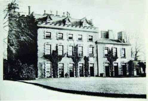
They spent money on the Church and on their Court specially Sir Richard Arthur who in 1455 married Alice the daughter of the Lord of Berkeley Castle. However the last male Arthur died in 1595 and William Wynter 1 from Dyhram married the eldest Mary Arthur and became the new Lord of the Manor. They overcame some troubled times in the Civil War when William Wynter 2 died in a Parliamentary prison only for the whole manor having to be sold to pay for the gambling debts of Henry Wynter in 1690 and the Court became a farm.
Although a farm it has some notable owners James Davis (Victorian Mining), Sir Edward Payson Wills (see later) and Constantine Stevens (Eastville Stadium owner) all of whom have supported the adjacent church.
(d) The Church
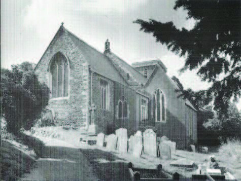
The first written record of St Michael’s church is early in the 13c but likely a church existed before this, perhaps on a pagan worship site. Churches on Hills are often dedicated to St Michael e.g. Glastonbury Tor. The oldest parts of the church are the mutilated lintel above the south door, the blocked North door and the Chancel’s priest door. The wooden pews at the rear have been tree ring dated to 1423-53. The North or Manorial Chapel contains the Arthur Family graves and a large monument intended for the whole Wynter family but only recording the death of baby Edmund in 1671.
A residential Rector was only present in the village from 1850 to1950, previously the Rectory on Wood Lane was known as Parsonage Farm. Sadly the church closed in 1995 and was taken over by the Churches Conservation Trust and 4 services a year plus B, M & D are held by the East Clevedon Benefice and the Friends of St Michael’s. The C of E School opposite the Black Horse opened in 1858, closed in 1974 and soon became a private house; which was a great loss as it was used as a village hall. The church is only a 10 min walk and it is hoped to heat the chapel for community purposes. Often Churches are located close to the Manor/Court and coal mining or black death are said to be reasons why the village has moved eastwards. It is more likely it was sited there in the first place as the water supply and road system was better. Remember very few horse & carts would be capable of going up Naish Hill and Bristol is still signposted via Caswell Lane and Nailsea would have been accessed via Wood Lane.
(e) Naish House
In 1327 there is a Wraxall tax record for Johanne ate Nasch which may explain why Naish House on the top of the hill is still locally pronounced as “Nash”. The Mansion has had some interesting owners including the religious Kemey sisters who entertained the disposed Bishop Ken in Stuart times. In the 18/19c like other North Somerset Country Houses their wealth came from the West Indies/American sugar & tobacco trade using African Slave Labour. From 1822-55 James Adam Gordon the owner of Plantations in St Vincent & Antigua owned Naish House.
He enhanced the mansion and the grounds in the Gothic manner. He was wealthy, well educated, a supporter of the arts, advocate change agriculture practises and a man of considerable influence in North Somerset. He was an MP for a rotten borough in Cornwall but the 1832 Reform Act ended this and his attempt to become a local MP failed. There was considerable unrest in the countryside as falling corn prices resulted in reduced agriculture wages plus the 1831 Bristol riots indicated that a stand for law & order should be made. James Adam Gordon as Somerset’s County Sherriff in 1833 is therefore well remembered as being in charge of the last public hanging in England to take place at the scene of the crime. Three farm labourers were hanged in the very meadow where they had set fire to Hay Mows (ricks) in nearby Kenn in front of a large crowd. The next owner of Naish was Colonel Pilgrim who fought at Balaclava in the Crimean War and brought back his horse and buried it in the grounds. Lady Smythe later owned & rented the property out, to High Court Judge amongst others and finally as a Private School. The mansion was burnt to the ground on Xmas Day 1902 when fortunately the pupils were on holiday. In 1939 a much smaller house was built in the then outdated Arts & Craft style by Doctor Chitty with the old Gordon Family stone Boars Heads on show.
(f) Agriculture
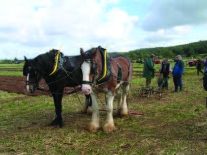
Farming was the dominate activity in Clapton until the 21st c, the early years centred on ‘serfs’ working for theLord of the Manor on his land in return for being able to work for themselves on strips of land on the commonfields. With time small farmers owned land & were proudly remembered with the wording “Yeoman of this Parish” on their headstone. The 1840 Tythe records the land use:- Total Land subject to tythes 1048 acres, Arable land 120 acres, Meadow of Pasture land 663 acres, Woodland 101 acres, Common lands 106 acres consists of moorland grazed in summer and held in right of the old auster tenements in the village. Drainage Boards were set up and the land greatly improved, farm details recorded in the 1881 census:-
| Brook Farm | George Price 40 acres & 1 lab |
| Cherry Orchard Farm | Robert James 20 acres & 2 labs |
| Clapton Court | James Davis 350 acres, 10 labs &2 boys |
| Clapton Farm | Edwin Hardwick 116 acres & 2 labs |
| Clapton Wick Farm* | Henry Southcott 141 acres & 3 labs |
| Hoopers Farm | John Jordan 26 acres |
| Kennel Farm | John Perkins 156 acres & 2 labs |
| Naish Farm | William Perrott 133 acres & 2 labs |
| Sperrings Farm | Jeffrey Burnet 70 acres |
| Stratton Farm* | George Evans 95 acres |
| Village Farm* | William Thomas 43 acres & 1 lab |
| Wynol Nursery* | John Crook Jordan |
* then in Portbury Parish, $ includes New Farm. The description ‘Farmer Labourer’ much understated a range of skills included milking, horse ploughing, laying a hedge, vet nary skills, butchering up a pig, sheep shearing, corn thrashing, plus driving livestock to Yatton/Portbury Markets. The James Family were pioneers with their steam driven corn mill in Caswell Lane and their mobile steam engines for thrashing, sadly their attempt to import a modern American tractor ended when the ship carrying it was sunk by ‘jerry’ early in WW2. Mechanisation has changed farming dramatically with greatly reduced numbers employed, larger fields and silage instead of hay. Disease is still a threat, currently TB is a lingering curse but BSE plus foot & mouth at the end of the 20th c were serious events. The economics of dairy production has reduced farming in the valley, together with an influx of equine activity and nature reserves. Opinion is divided on this subject.
(g) Coal Mining
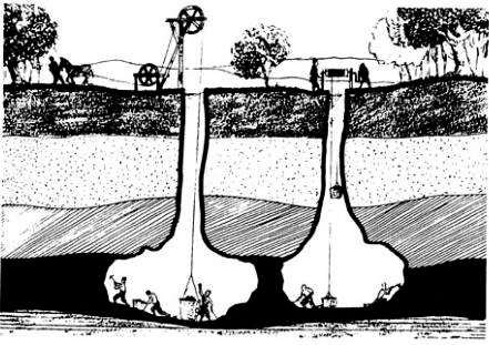
Medieval coal mining took place in a small valley which runs from behind the Black Horse down through Clapton Farm’s Orchard. This is marked on the geological map and by the ‘gruffy’ ground left by the miner’s bell pits. Holes known as bell pits were dug in the ground to find the seam of coal which was then mined for short distance without timber supports. When it became too dangerous and the thin coal seam was mined by digging a new bell pit dug some 20 yards away.
From about 1750 onwards mining moved up Wood Lane to the site of Glenny Wood scout camp. Here shafts 44 fathoms deep were dug and the coal was brought up. These mine had a drainage adit which comes at ‘the blows’ west of millennium wood and from which water still flows. The operation is described in 1795 thus:- At this pit are landed about 240 bushels daily. The best is at 31⁄2d per bushel, and the small is shipped at Portishead-point for Wales, where it was used for burning lime”. However by 1840 these mines are closed but in the late 1860’s new mines are opened. A steam pumping engine house is built below church path and shafts are dug close to Nicholas wood and at New Farm. Shares could be purchased in ‘The Clapton Coal & Iron Company’ but it soon went to the wall in 1872 and the Kicker view was ‘that it was the water that beat them.’
(h) The 19th Century
The 19th C saw progress on civil matters one being the 1840 Tythe survey which mapped each field & house & although done to equalise payments to the parish church was the foundation of the later Ordnance Survey Maps.
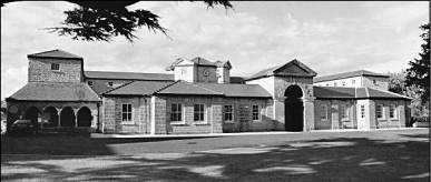
The first census was taken in 1840 but the 1851 one gave more detail and recorded 29 houses & 162 people in Clapton (2011 census 155 houses and 338 people). Agriculture improvements have been described previously including the enclosures and the shutting down of the white lion tidal mill which backed up water in the valley. The Bedminster Poor Law Union was formed in 1834 and included Clapton, its Work House shown above & still stands today in Cambridge Batch. Times were hard then, no signing on at the labour you risked either becoming a village pauper or living at the workhouse. A Parish Guardian was appointed who collected money from each household in the village and we have some of his records which help answer the often asked question who lived in my house.
(i) The 20th Century
WW1 & WW2 were the great events of 20th c and the loss of 4 villagers & a Canadian pilot are remembered in the Church Porch. The picture shows the villagers welcoming home the returning soldiers at the end of the Great War. In 1904 Sir Edward Wills became Baronet of Hazelwood & Stoke Bishop and Clapton in Gordano, he was part of the tobacco dynasty. He was Clapton’s Lord of the Manor and Churchwarden and likely lived weekends at Clapton Court perhaps drove the first car in Clapton.
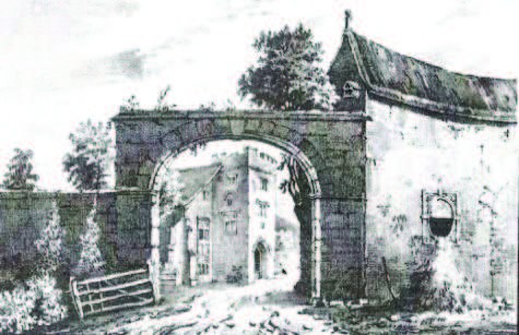
When he died in 1912 his property was sold at public auction and the sale document is a valuable record. Some of which were subsequently listed:- Grade 1 St Michaels Church, Grade 2 Little Naish, Coach House & stable, Gazebo’s, walls/steps & King John statue at Naish; Clapton Court & Entrance Archway; Stable block at Kennel Farm Old Rectory; The Black Horse, Myrtle Cottage; Jasmine Cottage Brook Farmhouse; Sperring’s Farmhouse; Clapton Farmhouse & attached Farm buildings.
The Parish was administered by an Annual Parish Meeting until 1950 when a Parish Council was formed of 5 members (now 6). For the 1969 Election there were 13 candidates. Traditionally Clapton was in Somerset and part of Long Ashton Rural District Council and an ardent supporter of Somerset CCC and Bristol City FC. However in 1974 it found itself in the new Avon County and Woodspring District Council but in 1996 Avon was abolished and Clapton was placed in North Somerset Unitary District Council. Currently there is debate about whether we will be part of a ‘South West Power House’.
Other important events in the 20c were the arrival of electricity in the 1930’s, piped water from Chelvey
through a tunnel above New Farm in 1952 and main sewage for some in about 1960. Mains gas could have come in 1990 but was declined and we await fibre broadband. Currently heating oil has become cheaper but……? Clapton Parish is some 3 miles long from the boundary stream just to the east of Redding Cottages to Clevedon Riding School in Clapton Wick. It is some 11⁄2 miles wide from the Big Rhine to Cadbury Camp Lane, houses on the south side of the latter lane are in Tickenham Parish.
A dominant feature on a map is the M5 which arrived in the early 1970’s & cuts the parish in half but in practise for most (but not all) the noise is tolerated. There is road bridge at Naish Hill, a tunnel at Wood Lane, a footbridge above New Farm and a spectacular viaduct at Wynol where it crosses the geological faults. (Wynol name derived from Windy Hole)
So far no serious accidents have occurred on ‘our’ section of motorway but there is potential, as some of us
were recipients of Normandy cauliflowers when a French lorry left the M5. There have been three parish boundary enlargements, the first in 1888 when Clapton Wick then an isolated tything belonging to Portbury Parish was transferred to Clapton when parliament required that all Parish/County boundaries to be contiguous. In 1954 Morgan’s Corner joined Clapton again from Portbury as did Naish House from Wraxall in about 1985 after local pressure.
(j) The 21st Century
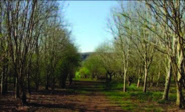
In the 21st C Millennium Wood was planted in conjunction with the Woodland Trust and a new walk created with Avon Wild Life known as the Clapton Circuit over their newly created Clapton Moor Reserve. There are many other footpaths as well plus a national cycle way along Clevedon and Caswell Lanes and this has resulted in the village being a very popular with Walkers, Cyclists and Horse Riders.
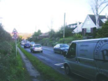
The expansion of Portishead plus the Police HQ (perhaps the Fire HQ as well) has greatly increased the road traffic along the unclassified Clapton Lane, which has become a major route into Bristol. King Canute efforts have been made to control it including a 20mph Zone and a weight limit. Most houses have 2 cars and this has resulted in the loss of a bus service. Walking to & from Portishead along Clapton Lane with the exception of early Sunday mornings is a challenge.
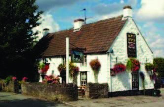
Save the best to last! This traditional pub deservedly earns its CAMRA recommendation & Grade 2 listing. Is has a long history and must have been at its liveliest in the 19c when it was next to a next cock fighting pit. This was made illegal in the UK in 1849 & its neighbour then called Cockfighting Cottage became a respectable Rose Cottage.
The Inn’s interior has attractive features including an inglenook fireplace always lit in winter and a spice
cupboard. Decisions are tough on whether to drink from the barrel:- Thatchers, Butcombe, Courage Best or the Guest Beer. Good Food is served at lunchtimes. The pub serves a wide community but the landlords John & Allison are very good to the village allowing the family room to be used for Parish Council & other meetings. The pub is quite unique in that it also becomes a polling station when local and national elections take place.
(Please advise David Hounsell 01275 844187 any errors or omissions.)
Sources:-
Tales of Gordano by Eve Wigan availble in Portished Library.
Antiquities of North Somerset by the Rev Collinson.*
Delinerations of NW Division of Somerset by John Rutter*
*out of copyright & can be read free on line on Google Books


